

Mountains-to-Sea Trail — Segment 8
7 days · 108.3 mi · strenuous · Point-to-point
Quick facts
What the Mountains-to-Sea Trail — Segment 8 is known for
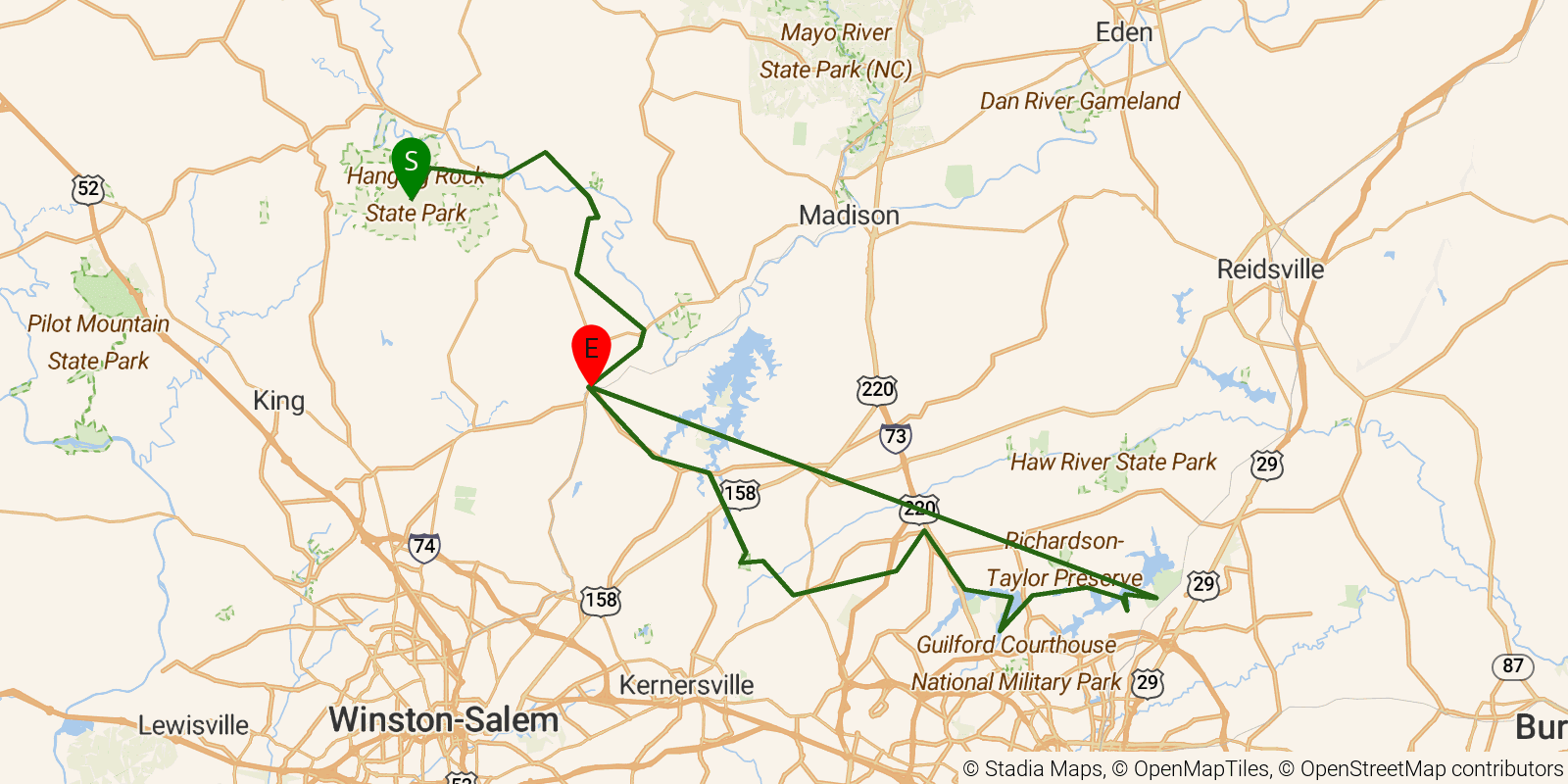
Segment 8 of the Mountains-to-Sea Trail — "Rivers, Railroads and Lakes" — stretches from Hanging Rock State Park southeast to Bryan Park in Greensboro, about 79 miles of rolling Piedmont terrain tracing the Dan River corridor and the historic Atlantic and Yadkin Railroad route. The western end departs through mountain-influenced oak-hickory-beech forest before the trail settles into second-growth Piedmont woodland along the shores of Lake Brandt and Lake Townsend, passing Civil War-era Moratock Furnace and Priddy's General Store (operating since 1888). This 7-day easy-to-moderate section has a significant road-walking component through small Surry and Forsyth County towns and is well-suited for a first MST multi-day venture.
Elevation profile
Elevation ranges from 2,087 ft to 5,574 ft over 108.3 mi. Measured from OSM geometry (approximate).
- Uphill 15.8 mi · 15%
- Downhill 19.1 mi · 18%
- Flat 72.1 mi · 67%
Ridgefold breaks every route into uphill, downhill, and flat — see the full per-day breakdown in the app.
How hard is the Mountains-to-Sea Trail — Segment 8?
On the Ridgefold Difficulty Index, the Mountains-to-Sea Trail — Segment 8 scores 24/100, a relative rating across the 1,243 trails we've mapped, blending distance, elevation gain, and steepness. It is a comparison within our set, not an official rating.
Frequently asked questions
How much elevation gain is on the Mountains-to-Sea Trail — Segment 8?
The Mountains-to-Sea Trail — Segment 8 climbs roughly 5,449 ft total — about 50 ft per mile, topping out near 1,699 ft.
Related trails
Sources & attribution
Route geometry from OpenStreetMap, © OpenStreetMap contributors, ODbL 1.0 — source relation. Stats are approximate and may differ from official surveys; permit rules and conditions change — verify with the managing authority before your trip. Last reviewed July 2026.