

Annapurna Circuit
~11 days · 145 mi · strenuous · Multi-day trek
Quick facts
What the Annapurna Circuit is known for
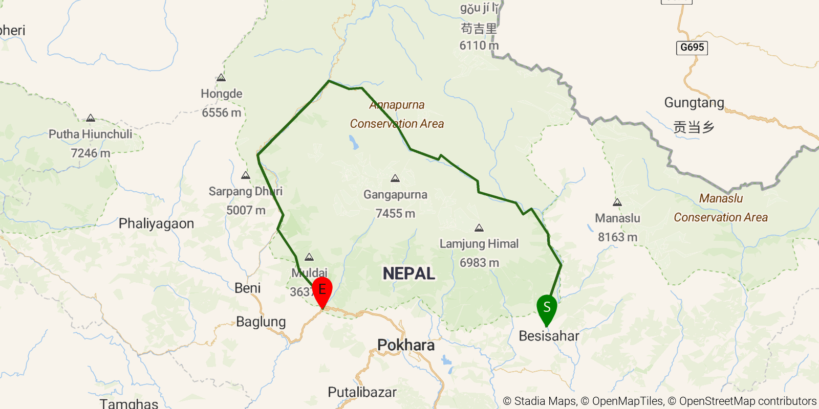
The Annapurna Circuit is a classic loop around the Annapurna massif in north-central Nepal, best known for crossing Thorong La — at 5,416 m (17,769 ft), one of the world's highest trekking passes. It links the green valleys of Manang with the arid, Tibetan-influenced highlands of Mustang and the pilgrimage site of Muktinath, and is traditionally walked as a teahouse trek, staying in village lodges rather than camping.
Elevation profile
Elevation ranges from 2,441 ft to 16,155 ft over 145 mi. Measured from OSM geometry (approximate).
- Uphill 74.7 mi · 39%
- Downhill 59.5 mi · 31%
- Flat 59.2 mi · 31%
Ridgefold breaks every route into uphill, downhill, and flat — see the full per-day breakdown in the app.
How hard is the Annapurna Circuit?
On the Ridgefold Difficulty Index, the Annapurna Circuit scores 96/100, a relative rating across the 569 trails we've mapped, blending distance, elevation gain, and steepness. It is a comparison within our set, not an official rating.
Best season & permits
Season: Best in spring (Mar–May) and autumn (Sep–Nov); winter snow can close Thorong La.
Permits: Requires ACAP entry and a TIMS card, arranged in Nepal.
Official trail & permit info
Always confirm current conditions, closures, and permit rules with the managing authority before your trip.
Frequently asked questions
How many days does the Annapurna Circuit take?
Most backpackers hike the Annapurna Circuit in about 11 days (10 nights out) over its 145 miles, though pace varies with fitness and conditions.
How much elevation gain is on the Annapurna Circuit?
The Annapurna Circuit climbs roughly 50,000 ft total — about 345 ft per mile, topping out near 17,890 ft.
When is the best time to hike the Annapurna Circuit?
Best in spring (Mar–May) and autumn (Sep–Nov); winter snow can close Thorong La.
Do you need a permit for the Annapurna Circuit?
Requires ACAP entry and a TIMS card, arranged in Nepal.
Related trails
Sources & attribution
Route geometry and stats derived from OpenStreetMap (© OpenStreetMap contributors, ODbL) — source relation. Distance/elevation cross-checked against Nepal ACAP (typical circuit). Stats are approximate and may differ from official surveys; permit rules and conditions change — verify with the managing authority before your trip. Last reviewed July 2026.