

Everest Base Camp Trek
12–14 days · 33.2 mi · hard · Point-to-point
Quick facts
What the Everest Base Camp Trek is known for
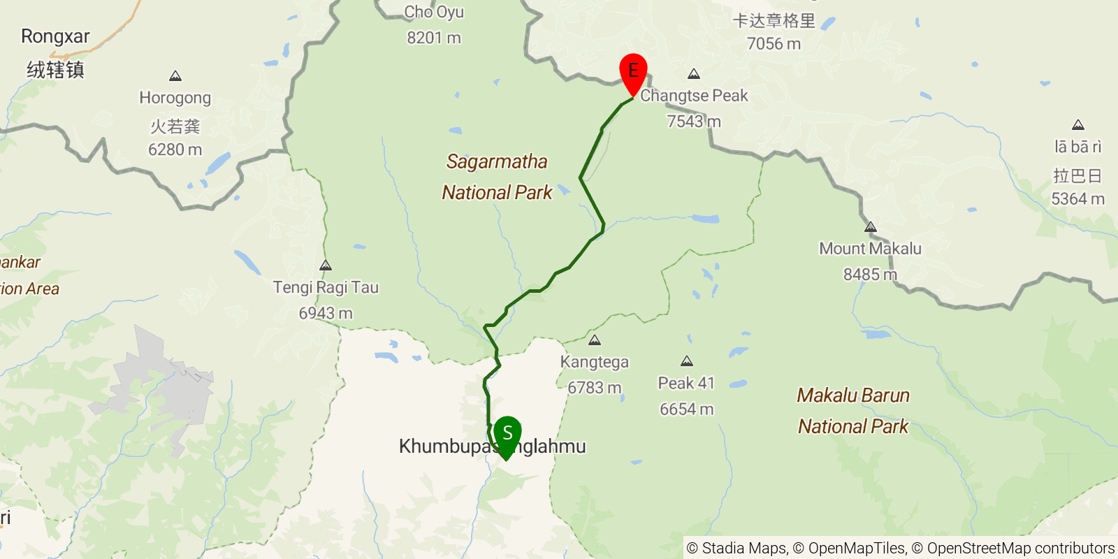
The classic teahouse trek through Nepal's Khumbu region of the Himalaya, running from the Lukla airstrip up the Dudh Koshi valley through Sherpa villages including Namche Bazaar and Tengboche, site of its landmark monastery, to Everest Base Camp at its commonly quoted 5,364 m (17,598 ft). Many trekkers add the ascent of Kala Patthar (about 5,545 m / 18,192 ft) for the standard viewpoint of Mount Everest, Lhotse, and Nuptse. It is a point-to-point trek staying in village teahouses, with acclimatization days built in for the altitude.
Elevation profile
Elevation ranges from 8,422 ft to 17,192 ft over 33.2 mi. Measured from OSM geometry (approximate).
- Uphill 22.5 mi · 71%
- Downhill 5.4 mi · 17%
- Flat 3.9 mi · 12%
Ridgefold breaks every route into uphill, downhill, and flat — see the full per-day breakdown in the app.
How hard is the Everest Base Camp Trek?
On the Ridgefold Difficulty Index, the Everest Base Camp Trek scores 57/100, a relative rating across the 569 trails we've mapped, blending distance, elevation gain, and steepness. It is a comparison within our set, not an official rating.
Best season & permits
Season: Best in spring (March-May) and autumn (late September-November) for stable weather and clear mountain views; the summer monsoon and deep winter cold are generally avoided.
Permits: Trekkers arrange permits in Nepal, typically the Khumbu Pasang Lhamu Rural Municipality entry permit and Sagarmatha National Park entry, plus the local trekkers' registration (formerly TIMS); no independent Western permit is issued in advance.
Official trail & permit info
Always confirm current conditions, closures, and permit rules with the managing authority before your trip.
Frequently asked questions
How many days does the Everest Base Camp Trek take?
Most backpackers take 12–14 days to hike the Everest Base Camp Trek's 33.2 miles, though pace varies with fitness and conditions.
How high does the Everest Base Camp Trek go?
The Everest Base Camp Trek tops out near 17,313 ft over its 33.2 miles.
When is the best time to hike the Everest Base Camp Trek?
Best in spring (March-May) and autumn (late September-November) for stable weather and clear mountain views; the summer monsoon and deep winter cold are generally avoided.
Do you need a permit for the Everest Base Camp Trek?
Trekkers arrange permits in Nepal, typically the Khumbu Pasang Lhamu Rural Municipality entry permit and Sagarmatha National Park entry, plus the local trekkers' registration (formerly TIMS); no independent Western permit is issued in advance.
Related trails
Sources & attribution
Route geometry and stats derived from OpenStreetMap (© OpenStreetMap contributors, ODbL) — source relation. Stats are approximate and may differ from official surveys; permit rules and conditions change — verify with the managing authority before your trip. Last reviewed July 2026.