

Cape Wrath Trail (Inchnadamph to Cape Wrath)
~5 days · 67.3 mi · hard · Point-to-point
Quick facts
What the Cape Wrath Trail (Inchnadamph to Cape Wrath) is known for
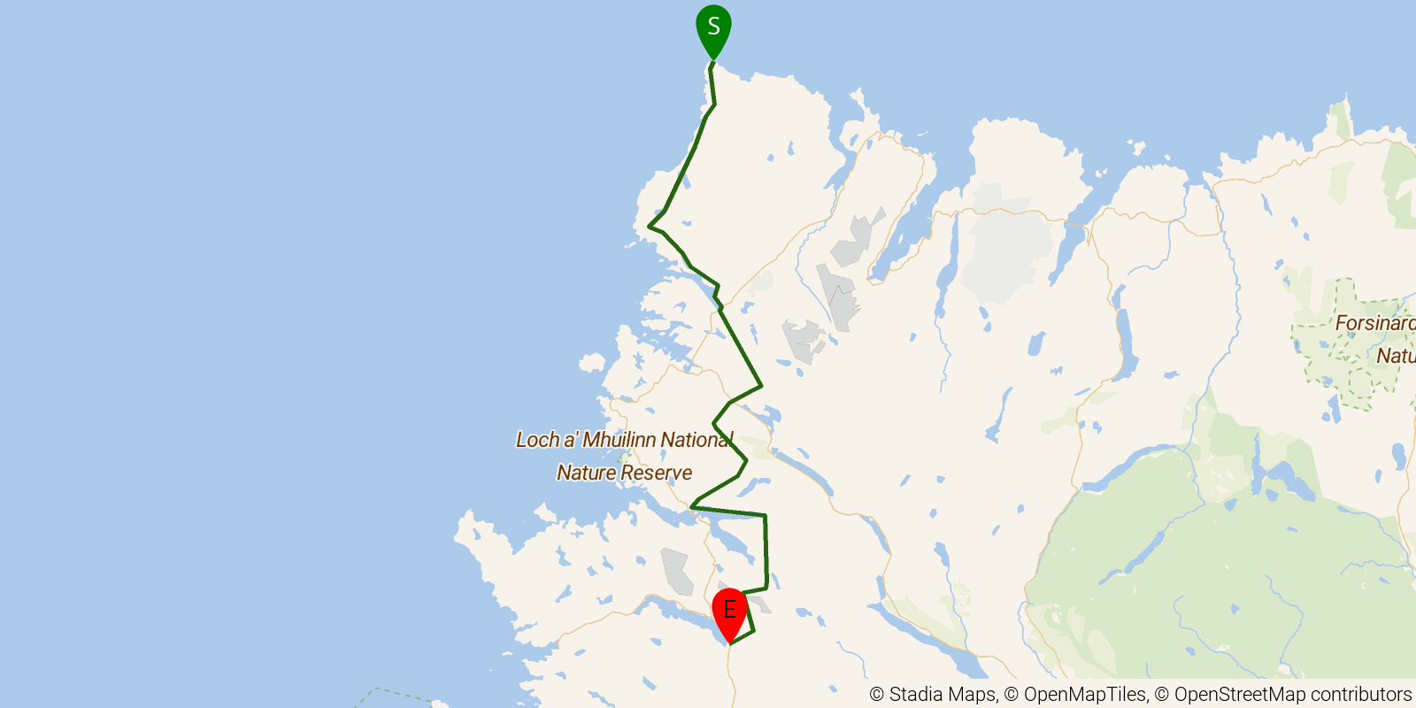
The Cape Wrath Trail is widely regarded as Britain's toughest long-distance backpacking route, and this section covers its wild final leg through the remote Sutherland Highlands. It is a point-to-point walk across largely trackless bog, river crossings, and mountains, running from Inchnadamph north to the lighthouse at Cape Wrath, the northwesternmost point of mainland Britain. The route is unwaymarked and passes through some of the most sparsely populated country in the UK. It is known for its remoteness, navigation demands, and exposure to Highland weather.
Elevation profile
Elevation ranges from 16 ft to 1,929 ft over 67.3 mi. Measured from OSM geometry (approximate).
- Uphill 14.2 mi · 21%
- Downhill 17.8 mi · 27%
- Flat 34.9 mi · 52%
Ridgefold breaks every route into uphill, downhill, and flat — see the full per-day breakdown in the app.
How hard is the Cape Wrath Trail (Inchnadamph to Cape Wrath)?
On the Ridgefold Difficulty Index, the Cape Wrath Trail (Inchnadamph to Cape Wrath) scores 33/100, a relative rating across the 569 trails we've mapped, blending distance, elevation gain, and steepness. It is a comparison within our set, not an official rating.
Best season & permits
Season: May to September is the practical window, with May and June offering longer daylight and fewer midges; river crossings become dangerous after heavy rain and winter brings short days and severe weather.
Permits: No permit is required to walk under Scotland's right-to-roam access laws, but the trail ends inside an active MoD firing range at Cape Wrath, so check whether live firing is scheduled before crossing the final section.
Official trail & permit info
Always confirm current conditions, closures, and permit rules with the managing authority before your trip.
Frequently asked questions
How many days does the Cape Wrath Trail (Inchnadamph to Cape Wrath) take?
Most backpackers hike the Cape Wrath Trail (Inchnadamph to Cape Wrath) in about 5 days (4 nights out) over its 67.3 miles, though pace varies with fitness and conditions.
How much elevation gain is on the Cape Wrath Trail (Inchnadamph to Cape Wrath)?
The Cape Wrath Trail (Inchnadamph to Cape Wrath) climbs roughly 10,394 ft total — about 154 ft per mile, topping out near 2,047 ft.
When is the best time to hike the Cape Wrath Trail (Inchnadamph to Cape Wrath)?
May to September is the practical window, with May and June offering longer daylight and fewer midges; river crossings become dangerous after heavy rain and winter brings short days and severe weather.
Do you need a permit for the Cape Wrath Trail (Inchnadamph to Cape Wrath)?
No permit is required to walk under Scotland's right-to-roam access laws, but the trail ends inside an active MoD firing range at Cape Wrath, so check whether live firing is scheduled before crossing the final section.
Related trails
Sources & attribution
Route geometry and stats derived from OpenStreetMap (© OpenStreetMap contributors, ODbL) — source relation. Stats are approximate and may differ from official surveys; permit rules and conditions change — verify with the managing authority before your trip. Last reviewed July 2026.