

Foothills Trail
5–7 days · 86.6 mi · strenuous · Point-to-point
Quick facts
What the Foothills Trail is known for
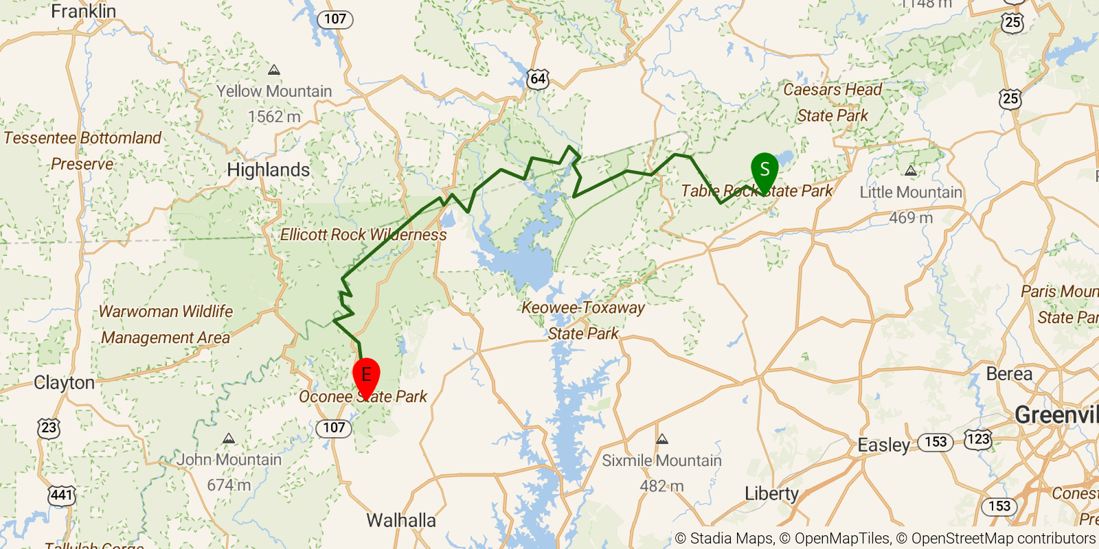
A long point-to-point trail across the Blue Ridge Escarpment of upstate South Carolina and the North Carolina line, connecting Oconee and Table Rock state parks. It passes Laurel Fork Falls, the Wild and Scenic Chattooga River, Whitewater Falls, and Sassafras Mountain, the highest point in South Carolina, along with the shoreline of Lake Jocassee. The trail is known for waterfalls, hardwood forest, and river gorge scenery.
Elevation profile
Elevation ranges from 1,122 ft to 3,360 ft over 86.6 mi. Measured from OSM geometry (approximate).
- Uphill 28.0 mi · 32%
- Downhill 27.0 mi · 31%
- Flat 31.2 mi · 36%
Ridgefold breaks every route into uphill, downhill, and flat — see the full per-day breakdown in the app.
How hard is the Foothills Trail?
On the Ridgefold Difficulty Index, the Foothills Trail scores 52/100, a relative rating across the 569 trails we've mapped, blending distance, elevation gain, and steepness. It is a comparison within our set, not an official rating.
Best season & permits
Season: Best in spring and fall for moderate temperatures and foliage, with waterfalls fullest after winter and spring rains; summer is hot and humid.
Permits: No permit is required to hike, though state-park trailhead parking and shuttle logistics apply at the endpoints and some access points.
Official trail & permit info
Always confirm current conditions, closures, and permit rules with the managing authority before your trip.
Frequently asked questions
How many days does the Foothills Trail take?
Most backpackers take 5–7 days to hike the Foothills Trail's 86.6 miles, though pace varies with fitness and conditions.
How much elevation gain is on the Foothills Trail?
The Foothills Trail climbs roughly 20,860 ft total — about 241 ft per mile, topping out near 3,530 ft.
When is the best time to hike the Foothills Trail?
Best in spring and fall for moderate temperatures and foliage, with waterfalls fullest after winter and spring rains; summer is hot and humid.
Do you need a permit for the Foothills Trail?
No permit is required to hike, though state-park trailhead parking and shuttle logistics apply at the endpoints and some access points.
Related trails
Sources & attribution
Route geometry and stats derived from OpenStreetMap (© OpenStreetMap contributors, ODbL) — source relation. Stats are approximate and may differ from official surveys; permit rules and conditions change — verify with the managing authority before your trip. Last reviewed July 2026.