

Mountains-to-Sea Trail — Segment 6
~5 days · 71.5 mi · strenuous · Point-to-point
Quick facts
What the Mountains-to-Sea Trail — Segment 6 is known for
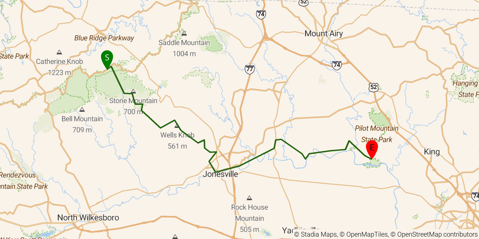
Segment 6 of the Mountains-to-Sea Trail — "The Elkin Valley" — descends from Devils Garden Overlook on the Blue Ridge Parkway through the dramatic foothills transition to Pilot Mountain State Park, about 57 miles marking the trail's shift from mountains to Piedmont. The route drops more than 2,000 feet in six miles through Stone Mountain State Park — with its imposing granite monolith, waterfalls, and rock-climbing faces — then traces the Yadkin River valley through the historic towns of Elkin and Rockford before finishing at the iconic quartzite summit of Pilot Mountain rising abruptly from rolling farmland. Difficulty ranges from very strenuous in the Stone Mountain section to easy-to-moderate along the lower Yadkin valley roads.
Elevation profile
Elevation ranges from 2,756 ft to 11,936 ft over 71.5 mi. Measured from OSM geometry (approximate).
- Uphill 19.0 mi · 27%
- Downhill 25.3 mi · 35%
- Flat 27.1 mi · 38%
Ridgefold breaks every route into uphill, downhill, and flat — see the full per-day breakdown in the app.
Frequently asked questions
How many days does the Mountains-to-Sea Trail — Segment 6 take?
Most backpackers hike the Mountains-to-Sea Trail — Segment 6 in about 5 days (4 nights out) over its 71.5 miles, though pace varies with fitness and conditions.
How much elevation gain is on the Mountains-to-Sea Trail — Segment 6?
The Mountains-to-Sea Trail — Segment 6 climbs roughly 6,437 ft total — about 90 ft per mile, topping out near 3,720 ft.
Related trails
Sources & attribution
Route geometry and stats derived from OpenStreetMap (© OpenStreetMap contributors, ODbL) — source relation. Stats are approximate and may differ from official surveys; permit rules and conditions change — verify with the managing authority before your trip. Last reviewed July 2026.