

North Country NST — Michigan
38 days · 1074.4 mi · strenuous · Point-to-point
Quick facts
What the North Country NST — Michigan is known for
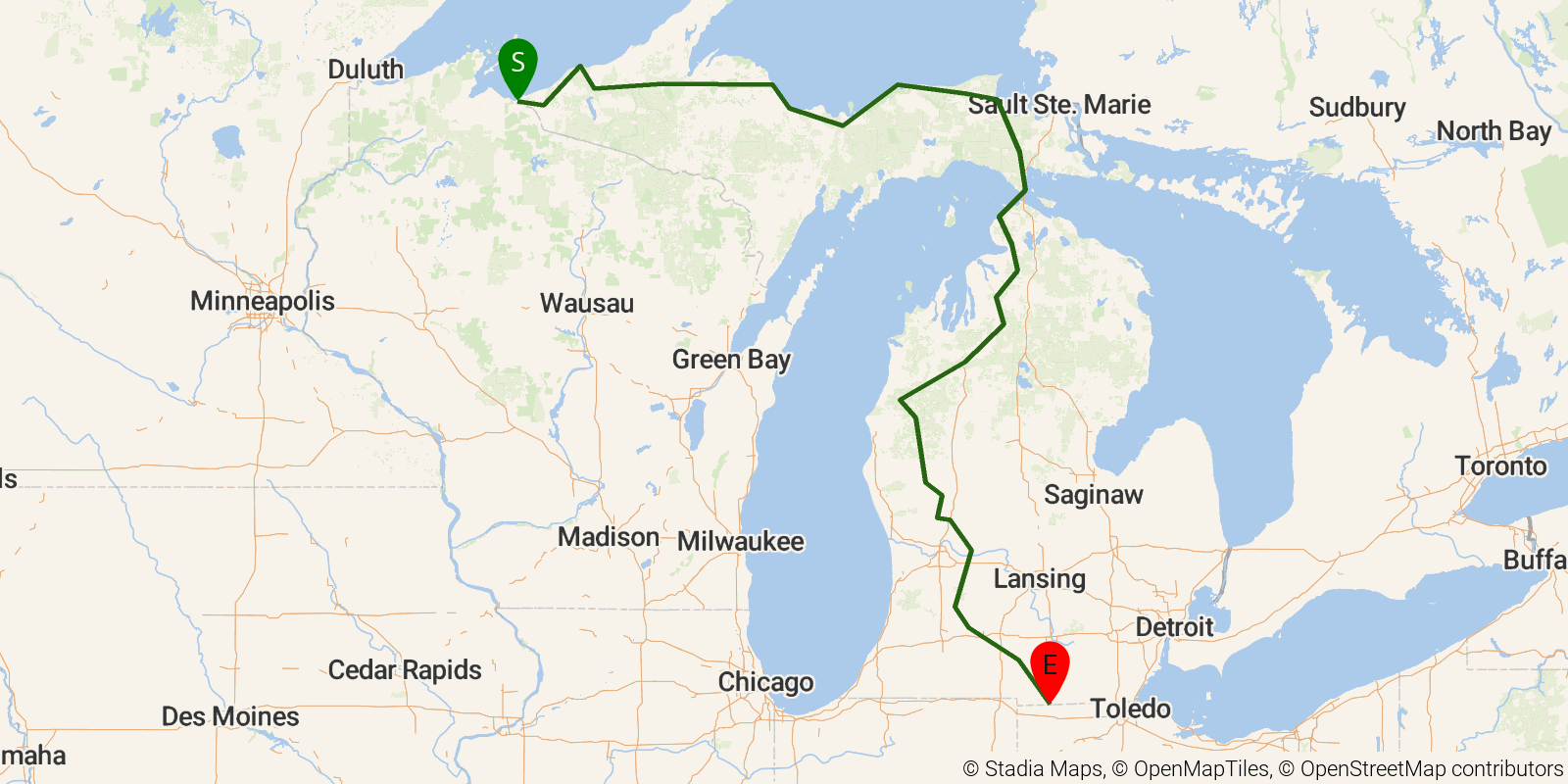
North Country NST — Michigan is a 45-65-day point-to-point traverse of both Michigan peninsulas, running from the Wisconsin border west of Ironwood to the Ohio state line south of Hillsdale. In the Upper Peninsula it passes through Ottawa National Forest, Hiawatha National Forest, and Pictured Rocks National Lakeshore along a dramatic Lake Superior shoreline of sandstone cliffs, beaches, and waterfalls, including Tahquamenon Falls; after crossing the Mackinac Bridge it continues through the Lower Peninsula's Huron-Manistee National Forests past river valleys, sand dunes along Lake Michigan, and rolling mixed hardwood forest.
Elevation profile
Elevation ranges from 1,906 ft to 6,017 ft over 1074.4 mi. Measured from OSM geometry (approximate).
- Uphill 53.0 mi · 5%
- Downhill 31.1 mi · 3%
- Flat 988.3 mi · 92%
Ridgefold breaks every route into uphill, downhill, and flat — see the full per-day breakdown in the app.
Frequently asked questions
How much elevation gain is on the North Country NST — Michigan?
The North Country NST — Michigan climbs roughly 45,292 ft total — about 42 ft per mile, topping out near 1,906 ft.
Related trails
Sources & attribution
Route geometry and stats derived from OpenStreetMap (© OpenStreetMap contributors, ODbL) — source relation. Stats are approximate and may differ from official surveys; permit rules and conditions change — verify with the managing authority before your trip. Last reviewed July 2026.