

Tongariro Northern Circuit
~3 days · 24.9 mi · moderate · Loop
Quick facts
What the Tongariro Northern Circuit is known for
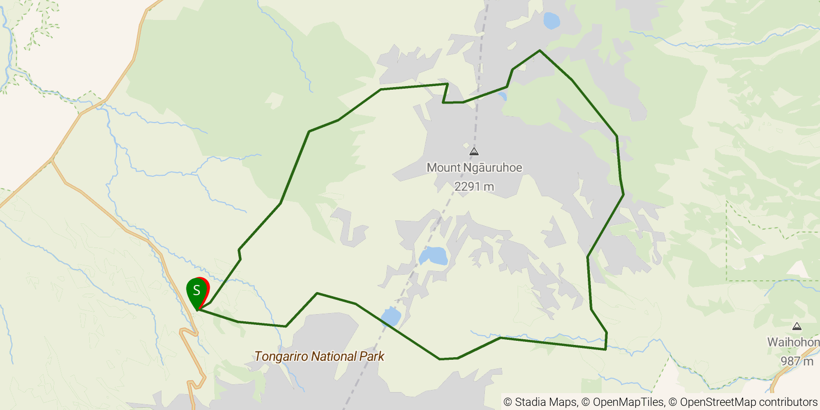
One of New Zealand's ten Great Walks, this loop circuits the volcanic terrain of Tongariro National Park on the North Island, wrapping around Mount Ngauruhoe and beneath the summit of Mount Tongariro. The route passes the Emerald Lakes, steaming craters, old lava flows, and the Red Crater high point, and overlaps the well-known Tongariro Alpine Crossing on its most-traveled section. It is a hut-to-hut circuit through an active volcanic landscape and UNESCO dual World Heritage area.
Elevation profile
Elevation ranges from 3,530 ft to 6,070 ft over 24.9 mi. Measured from OSM geometry (approximate).
- Uphill 10.5 mi · 42%
- Downhill 8.0 mi · 32%
- Flat 6.4 mi · 26%
Ridgefold breaks every route into uphill, downhill, and flat — see the full per-day breakdown in the app.
How hard is the Tongariro Northern Circuit?
On the Ridgefold Difficulty Index, the Tongariro Northern Circuit scores 24/100, a relative rating across the 569 trails we've mapped, blending distance, elevation gain, and steepness. It is a comparison within our set, not an official rating.
Best season & permits
Season: The Great Walk season runs roughly late October to April, when the huts are staffed and the alpine passes are largely free of the snow and ice that make winter travel a mountaineering undertaking.
Permits: No entry permit is required, but during the Great Walk season a booking for the Department of Conservation huts or campsites along the circuit must be reserved in advance.
Official trail & permit info
Always confirm current conditions, closures, and permit rules with the managing authority before your trip.
Frequently asked questions
How many days does the Tongariro Northern Circuit take?
Most backpackers hike the Tongariro Northern Circuit in about 3 days (2 nights out) over its 24.9 miles, though pace varies with fitness and conditions.
How much elevation gain is on the Tongariro Northern Circuit?
The Tongariro Northern Circuit climbs roughly 5,098 ft total — about 205 ft per mile, topping out near 6,070 ft.
When is the best time to hike the Tongariro Northern Circuit?
The Great Walk season runs roughly late October to April, when the huts are staffed and the alpine passes are largely free of the snow and ice that make winter travel a mountaineering undertaking.
Do you need a permit for the Tongariro Northern Circuit?
No entry permit is required, but during the Great Walk season a booking for the Department of Conservation huts or campsites along the circuit must be reserved in advance.
Related trails
Sources & attribution
Route geometry and stats derived from OpenStreetMap (© OpenStreetMap contributors, ODbL) — source relation. Stats are approximate and may differ from official surveys; permit rules and conditions change — verify with the managing authority before your trip. Last reviewed July 2026.