

Tour des Écrins (GR54)
~9 days · 134.5 mi · strenuous · Point-to-point
Quick facts
What the Tour des Écrins (GR54) is known for
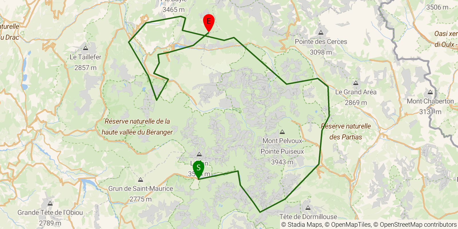
The GR54, or Tour des Écrins, is a demanding loop around the Écrins massif in the French Alps of Dauphiné, crossing more than a dozen cols through high pastures, glaciated peaks, and quiet valleys. It stays high and remote for much of its length, linking villages such as La Grave, Le Monêtier, and La Bérarde within and around Écrins National Park. It is walked as a multi-day hut-and-village circuit and is regarded as one of the tougher of the classic French GR tours.
Elevation profile
Elevation ranges from 2,369 ft to 8,688 ft over 134.5 mi. Measured from OSM geometry (approximate).
- Uphill 49.6 mi · 38%
- Downhill 59.8 mi · 46%
- Flat 21.0 mi · 16%
Ridgefold breaks every route into uphill, downhill, and flat — see the full per-day breakdown in the app.
How hard is the Tour des Écrins (GR54)?
On the Ridgefold Difficulty Index, the Tour des Écrins (GR54) scores 89/100, a relative rating across the 569 trails we've mapped, blending distance, elevation gain, and steepness. It is a comparison within our set, not an official rating.
Best season & permits
Season: Late June through September is the usual window, once the high cols have shed their snow and the mountain refuges are open and staffed.
Permits: No permit is needed to walk the GR54; overnight stays rely on booking beds at the mountain refuges and gîtes, and wild camping rules within Écrins National Park apply.
Official trail & permit info
Always confirm current conditions, closures, and permit rules with the managing authority before your trip.
Frequently asked questions
How many days does the Tour des Écrins (GR54) take?
Most backpackers hike the Tour des Écrins (GR54) in about 9 days (8 nights out) over its 134.5 miles, though pace varies with fitness and conditions.
How much elevation gain is on the Tour des Écrins (GR54)?
The Tour des Écrins (GR54) climbs roughly 44,783 ft total — about 333 ft per mile, topping out near 8,976 ft.
When is the best time to hike the Tour des Écrins (GR54)?
Late June through September is the usual window, once the high cols have shed their snow and the mountain refuges are open and staffed.
Do you need a permit for the Tour des Écrins (GR54)?
No permit is needed to walk the GR54; overnight stays rely on booking beds at the mountain refuges and gîtes, and wild camping rules within Écrins National Park apply.
Related trails
Sources & attribution
Route geometry and stats derived from OpenStreetMap (© OpenStreetMap contributors, ODbL) — source relation. Stats are approximate and may differ from official surveys; permit rules and conditions change — verify with the managing authority before your trip. Last reviewed July 2026.