

Tour de Monte Rosa
~7 days · 102 mi · hard · Multi-day trek
Quick facts
What the Tour de Monte Rosa is known for
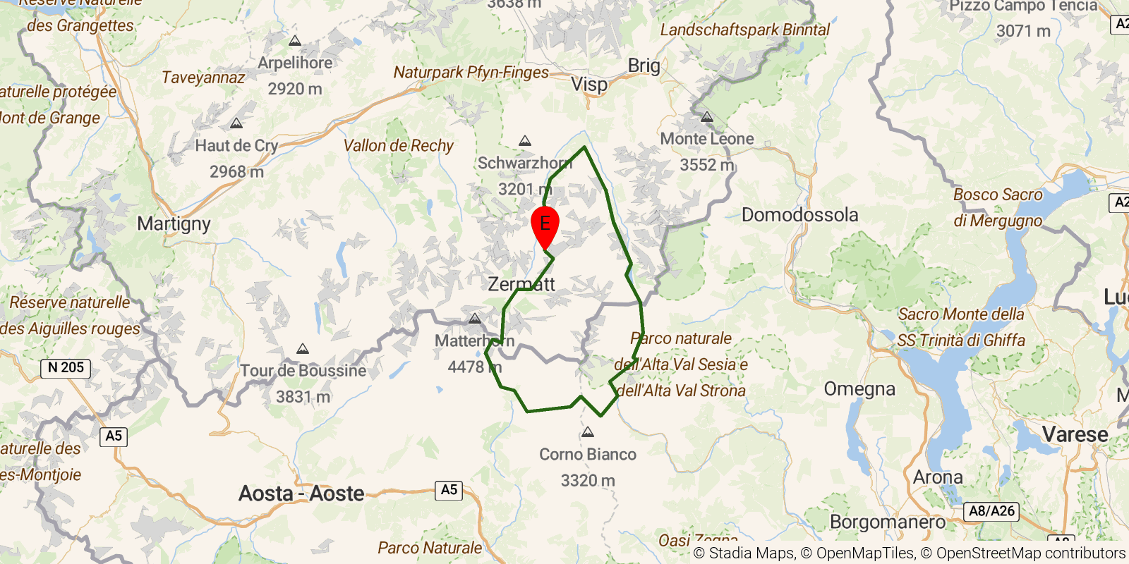
The Tour de Monte Rosa is a circuit of the Monte Rosa massif, the second-highest mountain group in the Alps, straddling the Swiss-Italian border. The route links Zermatt and Saas-Fee in Switzerland's Valais with the Italian valleys of Piedmont and the Aosta region, crossing high glaciated passes and traversing several distinct cultural valleys, including Walser communities. It is a hut-to-hut alpine circuit and is considered a serious undertaking, with some variants crossing glaciers that call for mountaineering skills.
Elevation profile
Elevation ranges from 4,173 ft to 10,459 ft over 102 mi. Measured from OSM geometry (approximate).
- Uphill 36.7 mi · 51%
- Downhill 31.4 mi · 43%
- Flat 4.4 mi · 6%
Ridgefold breaks every route into uphill, downhill, and flat — see the full per-day breakdown in the app.
How hard is the Tour de Monte Rosa?
On the Ridgefold Difficulty Index, the Tour de Monte Rosa scores 70/100, a relative rating across the 569 trails we've mapped, blending distance, elevation gain, and steepness. It is a comparison within our set, not an official rating.
Best season & permits
Season: Roughly late June to September, when the high passes are clear of snow and the alpine huts on both sides of the border are open.
Permits: No permit is required to hike it; overnight stays depend on reserving space in the mountain huts, and glacier variants demand appropriate equipment and experience rather than paperwork.
Frequently asked questions
How many days does the Tour de Monte Rosa take?
Most backpackers hike the Tour de Monte Rosa in about 7 days (6 nights out) over its 102 miles, though pace varies with fitness and conditions.
How much elevation gain is on the Tour de Monte Rosa?
The Tour de Monte Rosa climbs roughly 32,000 ft total — about 314 ft per mile, topping out near 10,866 ft.
When is the best time to hike the Tour de Monte Rosa?
Roughly late June to September, when the high passes are clear of snow and the alpine huts on both sides of the border are open.
Do you need a permit for the Tour de Monte Rosa?
No permit is required to hike it; overnight stays depend on reserving space in the mountain huts, and glacier variants demand appropriate equipment and experience rather than paperwork.
Related trails
Sources & attribution
Route geometry and stats derived from OpenStreetMap (© OpenStreetMap contributors, ODbL) — source relation. Distance/elevation cross-checked against Tour Monte Rosa official route. Stats are approximate and may differ from official surveys; permit rules and conditions change — verify with the managing authority before your trip. Last reviewed July 2026.