

Mountains-to-Sea Trail — Segment 5
5 days · 85.4 mi · strenuous · Point-to-point
Quick facts
What the Mountains-to-Sea Trail — Segment 5 is known for
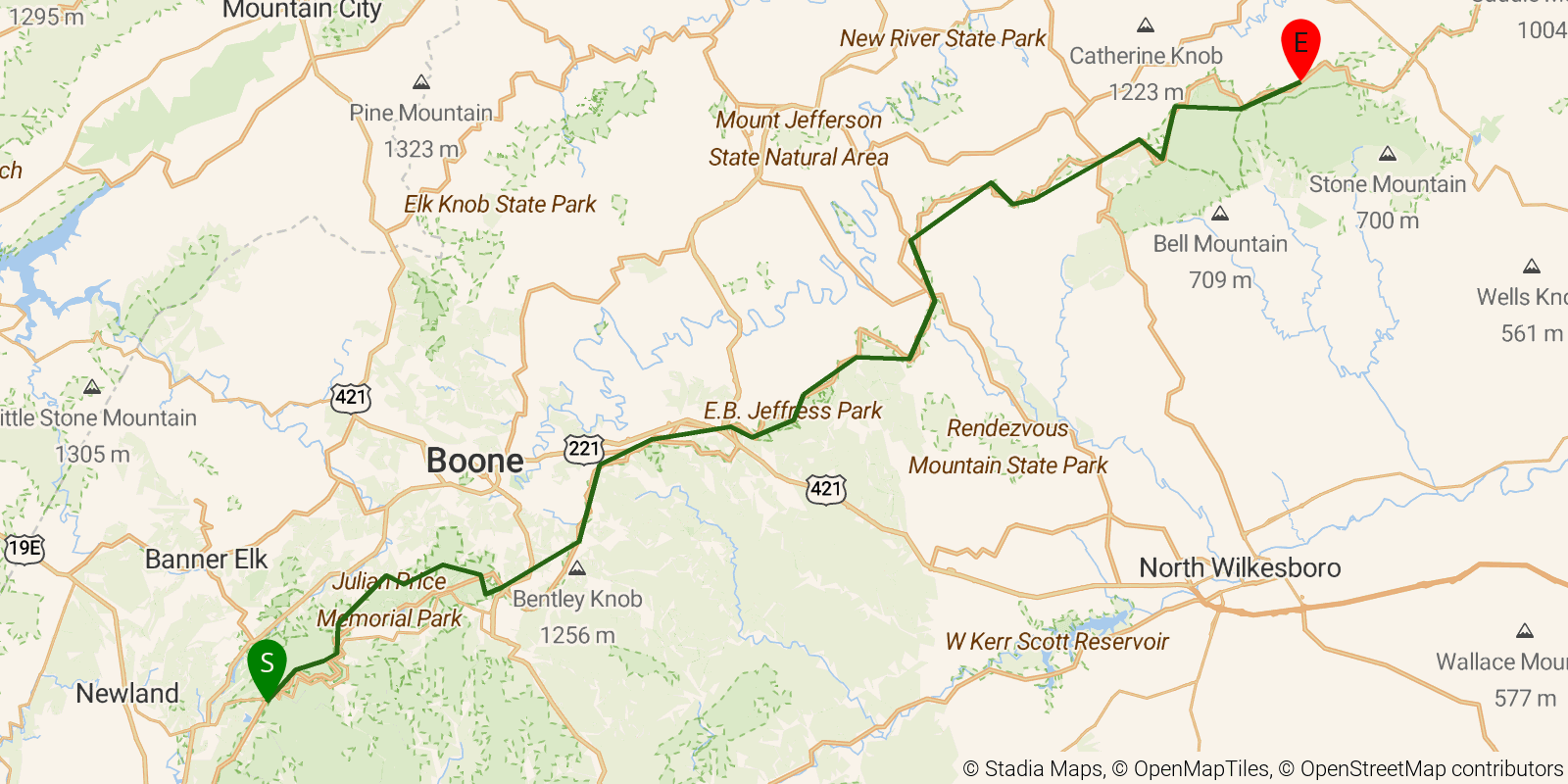
Segment 5 of the Mountains-to-Sea Trail — "The High Country" — runs from Beacon Heights near Grandfather Mountain north and east to Devils Garden Overlook on the Blue Ridge Parkway, about 65 miles of ridgeline hiking at elevations between 3,400 and 4,300 feet. The route passes the Linn Cove Viaduct's engineering marvel wrapping around Grandfather Mountain (one of only 553 UNESCO biosphere reserves worldwide), Moses H. Cone Memorial Park, and Doughton Park's open ridgeline camping, with the trail largely paralleling the parkway through well-engineered hardwood forest. This is a gentler 5-day stretch rated easy to moderate — high enough for cool temperatures and wide views, but with frequent road crossings and the Blowing Rock community nearby for resupply.
Elevation profile
Elevation ranges from 9,377 ft to 15,167 ft over 85.4 mi. Measured from OSM geometry (approximate).
- Uphill 33.0 mi · 39%
- Downhill 40.2 mi · 47%
- Flat 11.9 mi · 14%
Ridgefold breaks every route into uphill, downhill, and flat — see the full per-day breakdown in the app.
Frequently asked questions
How much elevation gain is on the Mountains-to-Sea Trail — Segment 5?
The Mountains-to-Sea Trail — Segment 5 climbs roughly 11,499 ft total — about 135 ft per mile, topping out near 4,678 ft.
Related trails
Sources & attribution
Route geometry and stats derived from OpenStreetMap (© OpenStreetMap contributors, ODbL) — source relation. Stats are approximate and may differ from official surveys; permit rules and conditions change — verify with the managing authority before your trip. Last reviewed July 2026.